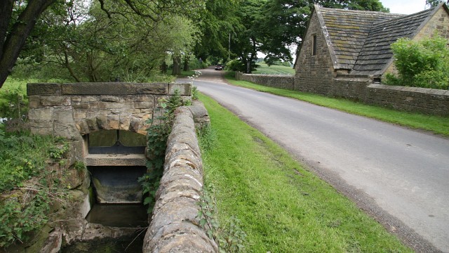
Hodmire Lane
Introduction
The photograph on this page of Hodmire Lane by Alan Walker as part of the Geograph project.
The Geograph project started in 2005 with the aim of publishing, organising and preserving representative images for every square kilometre of Great Britain, Ireland and the Isle of Man.
There are currently over 7.5m images from over 14,400 individuals and you can help contribute to the project by visiting https://www.geograph.org.uk

Image: © Alan Walker Taken: 31 May 2007
This northerly facing photograph shows the very western end of Hodmire Lane, which terminates at the junction (ahead) with the old Mill Lane (straight on) and an unnamed road (ahead, left), which leads to the new Mill Lane. Together the junction of the three roads forms a triangle of ground upon which is built the Image Behind the viewpoint the road turns to the right (easterly) and rises toward Ault Hucknall and the Hardwick plateau farms. The stream, which is called Stainsbybeck (no space according to the OS Map¹), and the sluice form part of the modern day water supply to Image² (on the right of the photograph). For a more northerly (ahead by a few metres) photograph of Hodmire Lane but looking back toward this viewpoint, click here Image ¹ Road name information from OS Maps at:- Elgin, http://www.elgin.gov.uk/ and the Mapping Portal of the Derbyshire Partnership, http://derbyshiremaps.derbyshire.gov.uk/ ² Photograph by John Fielding. See also this photograph by Derek Harper: Image

