The Thames at Windsor
Introduction
The photograph on this page of The Thames at Windsor by Gerald England as part of the Geograph project.
The Geograph project started in 2005 with the aim of publishing, organising and preserving representative images for every square kilometre of Great Britain, Ireland and the Isle of Man.

There are currently over 7.5m images from over 14,400 individuals and you can help contribute to the project by visiting https://www.geograph.org.uk
The Thames at Windsor
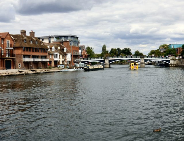
Image: © Gerald England Taken: 17 Jul 2018
The Grade II listed https://historicengland.org.uk/listing/the-list/list-entry/1210945 Eton boathouse on the left and the Grade II listed https://historicengland.org.uk/listing/the-list/list-entry/1117673 Windsor Bridge ahead.
Images are licensed for reuse under creativecommons.org/licenses/by-sa/2.0
Image Location
Latitude
51.48559
Longitude
-0.609157