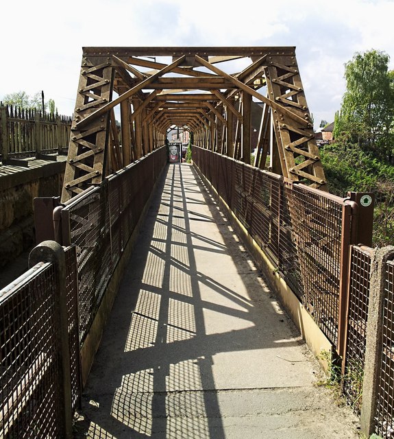
Kiveton Bridge Pedestrian Footbridge
Introduction
The photograph on this page of Kiveton Bridge Pedestrian Footbridge by Mike Nield as part of the Geograph project.
The Geograph project started in 2005 with the aim of publishing, organising and preserving representative images for every square kilometre of Great Britain, Ireland and the Isle of Man.
There are currently over 7.5m images from over 14,400 individuals and you can help contribute to the project by visiting https://www.geograph.org.uk

Image: © Mike Nield Taken: 22 Apr 2017
Kiveton Park, South Yorkshire "Kiveton Bridge" properly refers to the road bridge from which the adjacent railway station takes its name. The extremely busy road bridge - a glimpse of which can be seen on the left of this picture - carries the B6059 (Station Road) through the centre of the village, but has only a very narrow walkway on one side. For pedestrian safety and convenience, this footbridge is provided for those crossing the railway on the north side of Station Road. A second footbridge on the south side was originally intended for station passenger use and accessed through the road-level station booking office (demolished in the early 1970s), but now serves the general public as well as station users. Flickr: https://www.flickr.com/photos/128783627@N03/26541771549/in/photostream/

