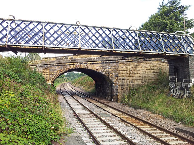
Kiveton Bridge and Station Footbridge
Introduction
The photograph on this page of Kiveton Bridge and Station Footbridge by Mike Nield as part of the Geograph project.
The Geograph project started in 2005 with the aim of publishing, organising and preserving representative images for every square kilometre of Great Britain, Ireland and the Isle of Man.
There are currently over 7.5m images from over 14,400 individuals and you can help contribute to the project by visiting https://www.geograph.org.uk

Image: © Mike Nield Taken: 20 Sep 2017
Kiveton Park, South Yorkshire. "Kiveton Bridge" properly refers to the road bridge from which the adjacent railway station takes its name. When the station opened in July 1929, passenger access to the two platforms was through the booking office, which was adjacent to the main road. Access to Platform 2 (for Sheffield-bound trains) was provided for by this overbridge. In the early 1970s the station was modernised and became destaffed. The now-redundant booking hall was subsequently demolished, but the footbridge remained and now serves not only passenger access across the line but general pedestrian access too, enabling them to avoid the narrow walkway across the road bridge. This photo is taken from the end of Platform 2 on Kiveton Bridge station, on the Down line looking towards Sheffield, and is as close as it's possible to get to photograph the bridge without going off the end of the platform and trespassing on the permanent way. An alternative view can be had by crossing the footbridge and peering through the latticed side. Flickr: https://www.flickr.com/photos/128783627@N03/38327911802/in/photostream/

