Calls Landing on the River Aire in Leeds
Introduction
The photograph on this page of Calls Landing on the River Aire in Leeds by Mat Fascione as part of the Geograph project.
The Geograph project started in 2005 with the aim of publishing, organising and preserving representative images for every square kilometre of Great Britain, Ireland and the Isle of Man.

There are currently over 7.5m images from over 14,400 individuals and you can help contribute to the project by visiting https://www.geograph.org.uk
Calls Landing on the River Aire in Leeds
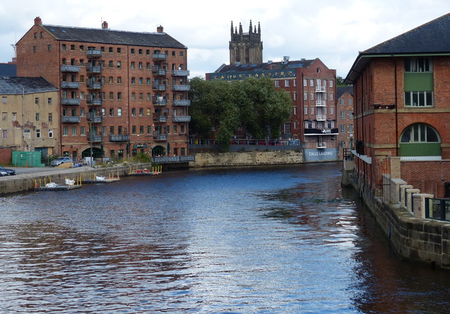
Image: © Mat Fascione Taken: 4 Aug 2017
Looking east from Leeds Bridge. The Calls was formerly an area of industry in Leeds along the banks of the River Aire. It is now regenerated with a mixture of offices, residential and leisure. In the distance is the tower of the Minster and Parish Church of Saint Peter-at-Leeds.
Images are licensed for reuse under creativecommons.org/licenses/by-sa/2.0
Image Location
Latitude
53.794231
Longitude
-1.540602