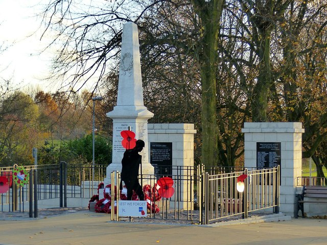
Eastwood War Memorial
Introduction
The photograph on this page of Eastwood War Memorial by Alan Murray-Rust as part of the Geograph project.
The Geograph project started in 2005 with the aim of publishing, organising and preserving representative images for every square kilometre of Great Britain, Ireland and the Isle of Man.
There are currently over 7.5m images from over 14,400 individuals and you can help contribute to the project by visiting https://www.geograph.org.uk

Image: © Alan Murray-Rust Taken: 12 Nov 2018
The memorial was originally sited on a plot of land near to the Cemetery Chapel off Church Street (approximately 1 km away), but was moved to its present, more prominent, location in 1978. It was further transformed in 2010 with the addition of the wall and panels at the rear, the latter displaying names of victims of the First World War not recorded on the original obelisk. The railings round the obelisk were erected at the same time, replacing chain link fencing. The original elements of the memorial, originally dedicated in 1921, are Listed Grade II.

