Manor Farm, Brinsley
Introduction
The photograph on this page of Manor Farm, Brinsley by Alan Murray-Rust as part of the Geograph project.
The Geograph project started in 2005 with the aim of publishing, organising and preserving representative images for every square kilometre of Great Britain, Ireland and the Isle of Man.

There are currently over 7.5m images from over 14,400 individuals and you can help contribute to the project by visiting https://www.geograph.org.uk
Manor Farm, Brinsley
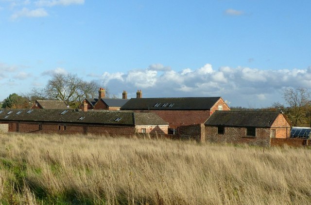
Image: © Alan Murray-Rust Taken: 12 Nov 2018
Victorian farmstead, clearly built as a single development. A feature is the use of decorative polychrome brickwork. The farm outbuildings appear to have been converted for residential use
Images are licensed for reuse under creativecommons.org/licenses/by-sa/2.0
Image Location
Latitude
53.033789
Longitude
-1.315194