River Soar west of Thurmaston, Leicestershire
Introduction
The photograph on this page of River Soar west of Thurmaston, Leicestershire by Roger Kidd as part of the Geograph project.
The Geograph project started in 2005 with the aim of publishing, organising and preserving representative images for every square kilometre of Great Britain, Ireland and the Isle of Man.

There are currently over 7.5m images from over 14,400 individuals and you can help contribute to the project by visiting https://www.geograph.org.uk
River Soar west of Thurmaston, Leicestershire
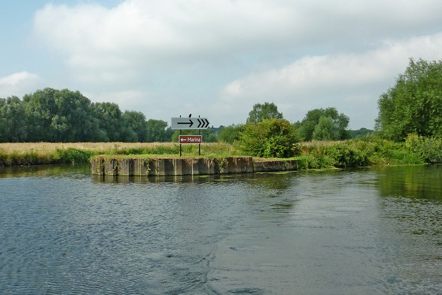
Image: © Roger Kidd Taken: 26 Aug 2013
The meandering River Soar is seen here, looking upstream near Thurmaston. Leicester Marina is to the left; Birstall Lock is to the right just over half a mile away. The river flows by and through the extensive Watermead Country Park for about four miles north of Leicester. There are many large lakes which are former gravel pits. For some sections, the navigation reverts to canalised status, part of the Grand Union Canal (Leicester Section). https://www.leicscountryparks.org.uk/watermead-visitor-information/ https://en.wikipedia.org/wiki/Watermead_Country_Park
Images are licensed for reuse under creativecommons.org/licenses/by-sa/2.0
Image Location


Leaflet Map data © OpenStreetMap
Latitude
52.6773
Longitude
-1.104836