Field between Shell's Farm and Kelly's Farm, Shepton Beauchamp
Introduction
The photograph on this page of Field between Shell's Farm and Kelly's Farm, Shepton Beauchamp by Kate Jewell as part of the Geograph project.
The Geograph project started in 2005 with the aim of publishing, organising and preserving representative images for every square kilometre of Great Britain, Ireland and the Isle of Man.

There are currently over 7.5m images from over 14,400 individuals and you can help contribute to the project by visiting https://www.geograph.org.uk
Field between Shell's Farm and Kelly's Farm, Shepton Beauchamp
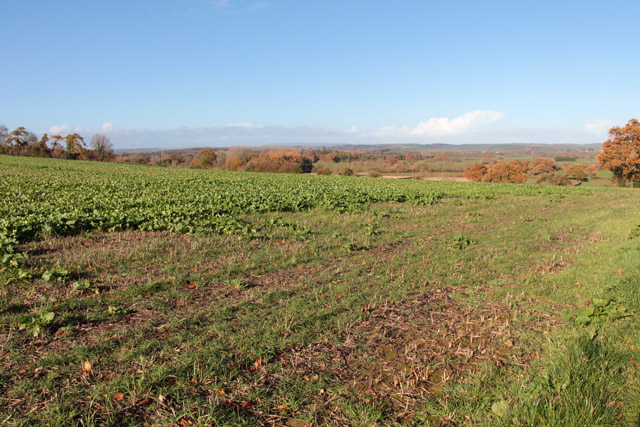
Image: © Kate Jewell Taken: 11 Nov 2018
On the high ground to the north of the village this large, open field is down to a cover crop of turnips. This is a useful, quick germinating, crop helping to prevent soil compaction that can occur in the sandy silt-like loam soil in this area. The plants break up the soil while they are in the ground, like a natural plough. Turnips are an excellent cover crop for farmers who graze livestock on their fields after the main cereal harvest. The lower lying land in the far distance is West Moor and the River Isle valley. Beyond the hills on the far horizon are the Somerset Levels.
Images are licensed for reuse under creativecommons.org/licenses/by-sa/2.0
Image Location
Latitude
50.956596
Longitude
-2.846032