Foulartoun Arches Bridge - Irvine
Introduction
The photograph on this page of Foulartoun Arches Bridge - Irvine by Ian Rainey as part of the Geograph project.
The Geograph project started in 2005 with the aim of publishing, organising and preserving representative images for every square kilometre of Great Britain, Ireland and the Isle of Man.

There are currently over 7.5m images from over 14,400 individuals and you can help contribute to the project by visiting https://www.geograph.org.uk
Foulartoun Arches Bridge - Irvine
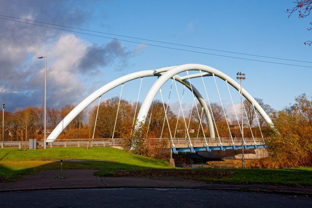
Image: © Ian Rainey Taken: 13 Nov 2018
Opened on 21st May 2010 it replaced the Bailey Bridge previously at this site. The old Bailey-style bridge was supposed to be in place for four years and ended up being there for 38 years. It was in a terrible state and had to be replaced as a matter of urgency. The name Foulartoun is old Saxon for Fullarton which is the area the bridge is situated. Foulartoun is understood to come from the occupation of a family who provided fowl to the King. The new bridge was officially named by primary five and six pupils from Loudoun-Montgomery Primary School
Images are licensed for reuse under creativecommons.org/licenses/by-sa/2.0
Image Location
Latitude
55.607852
Longitude
-4.661125