Well head
Introduction
The photograph on this page of Well head by Ian Capper as part of the Geograph project.
The Geograph project started in 2005 with the aim of publishing, organising and preserving representative images for every square kilometre of Great Britain, Ireland and the Isle of Man.

There are currently over 7.5m images from over 14,400 individuals and you can help contribute to the project by visiting https://www.geograph.org.uk
Well head
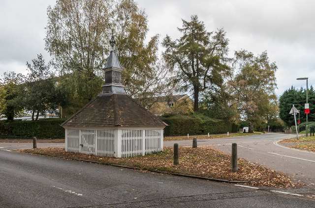
Image: © Ian Capper Taken: 27 Oct 2018
18th Century well head at the junction of Woodmansterne Land and Park Road, still with its winding gear over a 300 foot deep well. Grade II listed - see www.historicengland.org.uk/listing/the-list/list-entry/1178243.
Images are licensed for reuse under creativecommons.org/licenses/by-sa/2.0
Image Location
Latitude
51.324058
Longitude
-0.194333