Castle House
Introduction
The photograph on this page of Castle House by Ian Capper as part of the Geograph project.
The Geograph project started in 2005 with the aim of publishing, organising and preserving representative images for every square kilometre of Great Britain, Ireland and the Isle of Man.

There are currently over 7.5m images from over 14,400 individuals and you can help contribute to the project by visiting https://www.geograph.org.uk
Castle House
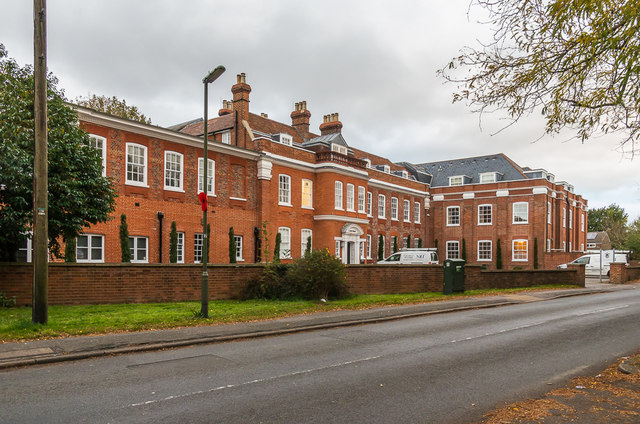
Image: © Ian Capper Taken: 27 Oct 2018
Originally built in 1770 as Rooks Nest. In 1903 it was purchased by a Mr A Browning to house a prep school, and renamed Rosehill. The school moved out in 1939, after which the building was used for offices, with the building later being renamed Castle House. In 2002, the north section was rebuilt as housing, although the southern end remains in commercial use. Grade II listed - see www.historicengland.org.uk/listing/the-list/list-entry/1029035.
Images are licensed for reuse under creativecommons.org/licenses/by-sa/2.0
Image Location


Leaflet Map data © OpenStreetMap
Latitude
51.322988
Longitude
-0.194303