Cymric Mill during the building of Cwrt Cei Coed
Introduction
The photograph on this page of Cymric Mill during the building of Cwrt Cei Coed by Penny Mayes as part of the Geograph project.
The Geograph project started in 2005 with the aim of publishing, organising and preserving representative images for every square kilometre of Great Britain, Ireland and the Isle of Man.

There are currently over 7.5m images from over 14,400 individuals and you can help contribute to the project by visiting https://www.geograph.org.uk
Cymric Mill during the building of Cwrt Cei Coed
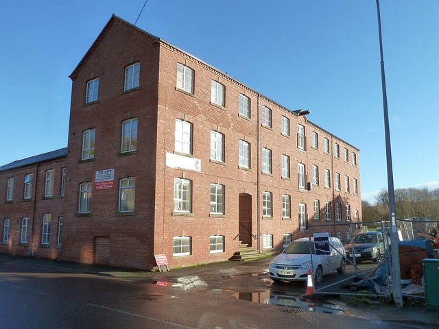
Image: © Penny Mayes Taken: 1 Jan 2018
This former tweed mill was converted into flats some years ago. The houses on the left are part of the original mill and were built at the same time, possibly to house workers. It used to back onto the canal but that was filled in long ago. The roadway beside it does provide access over the flood defences to the river. Photos of the building of Cwrt Cei Coed on the adjacent plot may be found here https://www.geograph.org.uk/snippet/18420
Images are licensed for reuse under creativecommons.org/licenses/by-sa/2.0
Image Location
Latitude
52.518131
Longitude
-3.305522