Info on RAF Winkleigh
Introduction
The photograph on this page of Info on RAF Winkleigh by John Douglas as part of the Geograph project.
The Geograph project started in 2005 with the aim of publishing, organising and preserving representative images for every square kilometre of Great Britain, Ireland and the Isle of Man.

There are currently over 7.5m images from over 14,400 individuals and you can help contribute to the project by visiting https://www.geograph.org.uk
Info on RAF Winkleigh
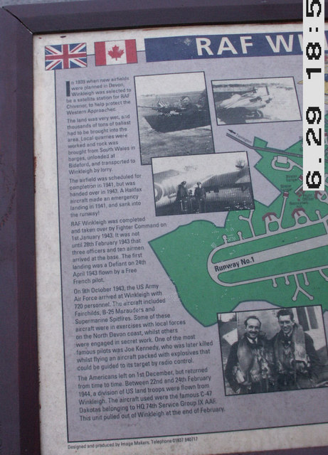
Image: © John Douglas Taken: 29 Jun 2007
Info board next to Memorial stone. See http://www.geograph.org.uk/photo/596759
Images are licensed for reuse under creativecommons.org/licenses/by-sa/2.0
Image Location


Leaflet Map data © OpenStreetMap
Latitude
50.866041
Longitude
-3.963407