St Albans: Trinity United Reformed Church
Introduction
The photograph on this page of St Albans: Trinity United Reformed Church by Nigel Cox as part of the Geograph project.
The Geograph project started in 2005 with the aim of publishing, organising and preserving representative images for every square kilometre of Great Britain, Ireland and the Isle of Man.

There are currently over 7.5m images from over 14,400 individuals and you can help contribute to the project by visiting https://www.geograph.org.uk
St Albans: Trinity United Reformed Church
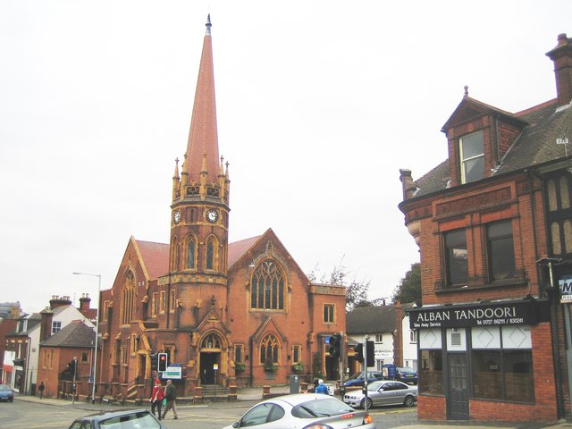
Image: © Nigel Cox Taken: 24 Oct 2007
Located in Beaconsfield Road at its junction with Victoria Street, the Church was completed and blessed on 8 October 1903, predating the nearby Catholic church by just over a year. The church suffered a disastrous fire in 1981 which left it as a roofless shell. There is a photo taken during the fire on the local BBC web page here http://www.bbc.co.uk/threecounties/content/articles/2006/02/14/stop_press_exhibition_feature.shtml The Church's own website is here http://www.trinitystalbans.org.uk/
Images are licensed for reuse under creativecommons.org/licenses/by-sa/2.0
Image Location
Latitude
51.750626
Longitude
-0.329546