Barnfields, Coed y Ffrid and Canal Road
Introduction
The photograph on this page of Barnfields, Coed y Ffrid and Canal Road by Penny Mayes as part of the Geograph project.
The Geograph project started in 2005 with the aim of publishing, organising and preserving representative images for every square kilometre of Great Britain, Ireland and the Isle of Man.

There are currently over 7.5m images from over 14,400 individuals and you can help contribute to the project by visiting https://www.geograph.org.uk
Barnfields, Coed y Ffrid and Canal Road
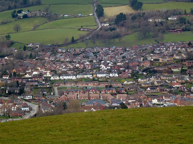
Image: © Penny Mayes Taken: 1 Apr 2018
The eastern parts of Newtown viewed from the ridge road to Dolfor. Heading north in the centre is Llanfair Road; the big house to its right is Plas-y-Bryn. The white terraces closer to the camera are Coed y Ffridd with the Barnfields estate, built in the 1960s and expanded in the 2000s, between the two. Just below Coed y Ffridd are the bungalows of Dinam terrace on Y Ffrydd, both built in the 1930s, I think. Below that are housing developments along Canal Road and Lower Canal Road, largely post WWII and some very recent. Bottom left is Cambrian Bridge, built in 1993 - see https://media.geograph.org.uk/view.php?id=3206 for a photo of it during construction, the viewpoint for this photo is roughly central at the top of the old one. See http://www.geograph.org.uk/photo/5966333 for a wider view.
Images are licensed for reuse under creativecommons.org/licenses/by-sa/2.0
Image Location
Latitude
52.518179
Longitude
-3.309356