View from the ridge road to Dolfor
Introduction
The photograph on this page of View from the ridge road to Dolfor by Penny Mayes as part of the Geograph project.
The Geograph project started in 2005 with the aim of publishing, organising and preserving representative images for every square kilometre of Great Britain, Ireland and the Isle of Man.

There are currently over 7.5m images from over 14,400 individuals and you can help contribute to the project by visiting https://www.geograph.org.uk
View from the ridge road to Dolfor
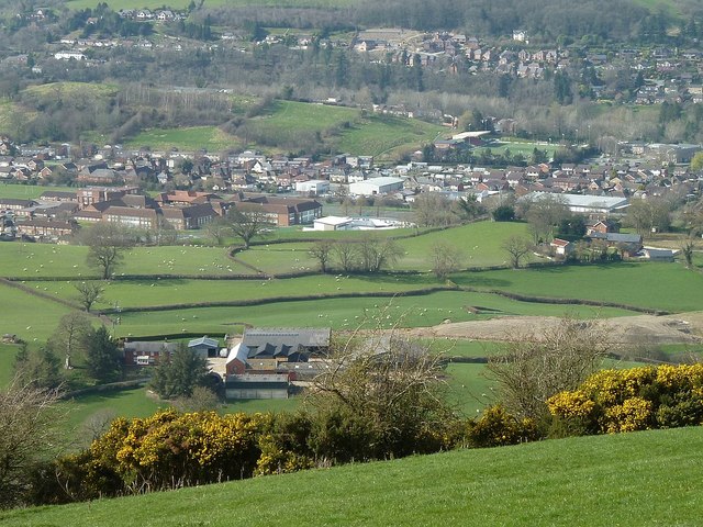
Image: © Penny Mayes Taken: 26 Mar 2017
The farm nearest the camera is Bryneira with bypass works just below it and Cefnaire a little further away on the right. The collection of large brick buildings left of centre is Newtown High School with the new Welsh medium primary school Ysgol Dafydd Llwyd (white roofs, partially hidden by the hill) to its right. The large grey roof to the right of that is the Lidl store on Llanidloes Road (A489) and beyond that, Latham Park football ground. The houses between them are part of the Trehafren estate which surrounds the hill to the left of the football ground. The houses near the top of the photo are across the river on or off Milford Road (B4568).
Images are licensed for reuse under creativecommons.org/licenses/by-sa/2.0
Image Location
Latitude
52.508361
Longitude
-3.319083