
Huntingdon East railway station (site), Cambridgeshire
Introduction
The photograph on this page of Huntingdon East railway station (site), Cambridgeshire by Nigel Thompson as part of the Geograph project.
The Geograph project started in 2005 with the aim of publishing, organising and preserving representative images for every square kilometre of Great Britain, Ireland and the Isle of Man.

There are currently over 7.5m images from over 14,400 individuals and you can help contribute to the project by visiting https://www.geograph.org.uk
Huntingdon East railway station (site), Cambridgeshire
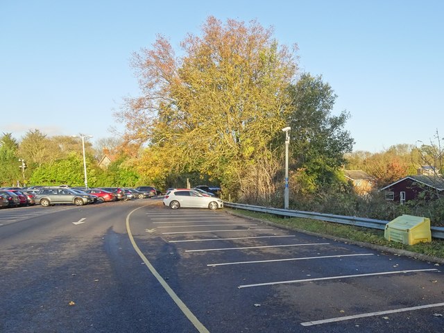
Image: © Nigel Thompson Taken: 2 Nov 2018
Opened in 1883 as "Huntingdon" jointly by the Great Northern and Great Eastern Railways on the line from Huntingdon to St. Ives, the station was renamed "Huntingdon East" in 1923. It closed to passengers in 1959 and completely in 1963. View north east towards Godmanchester and St. Ives along the course of the track and platforms, which followed the curved markings in the car park. The station was adjacent to the current Huntingdon station, and it is the car park for that station that has been extended over much of the site of the former station. For further information, see http://www.disused-stations.org.uk/g/godmanchester/index.shtml
Images are licensed for reuse under creativecommons.org/licenses/by-sa/2.0
Image Location

Latitude
52.327562
Longitude
-0.191672