St Osyth Ditch
Introduction
The photograph on this page of St Osyth Ditch by Nigel Cox as part of the Geograph project.
The Geograph project started in 2005 with the aim of publishing, organising and preserving representative images for every square kilometre of Great Britain, Ireland and the Isle of Man.

There are currently over 7.5m images from over 14,400 individuals and you can help contribute to the project by visiting https://www.geograph.org.uk
St Osyth Ditch
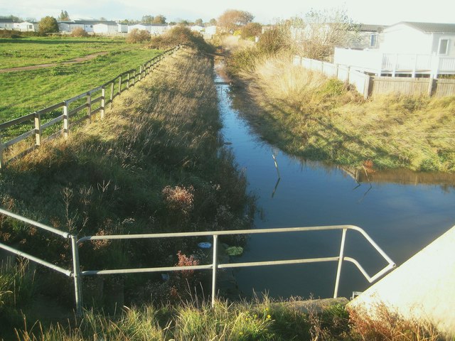
Image: © Nigel Cox Taken: 28 Oct 2018
St Osyth Ditch drains St Osyth Marsh. This is the view looking upstream from the Cockett Wick Sluice which allows water to drain out through the sea defence wall into the North Sea. Jaywick Ditch enters at the right so this is the confluence between the two ditches.
Images are licensed for reuse under creativecommons.org/licenses/by-sa/2.0
Image Location
Latitude
51.772797
Longitude
1.09578