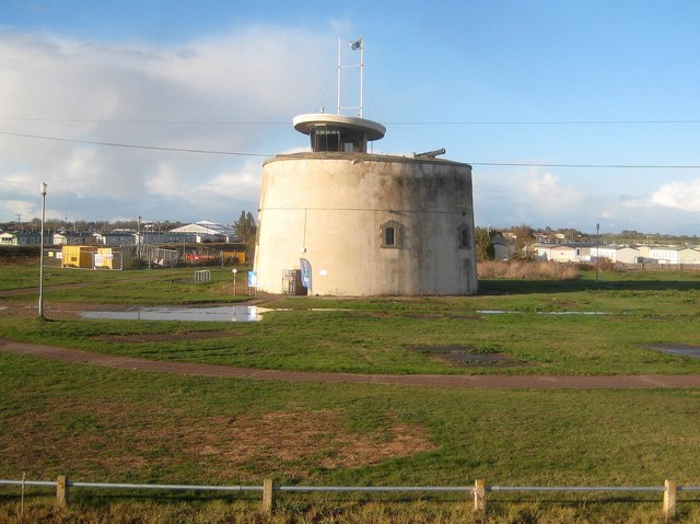
Jaywick: Martello Tower C
Introduction
The photograph on this page of Jaywick: Martello Tower C by Nigel Cox as part of the Geograph project.
The Geograph project started in 2005 with the aim of publishing, organising and preserving representative images for every square kilometre of Great Britain, Ireland and the Isle of Man.
There are currently over 7.5m images from over 14,400 individuals and you can help contribute to the project by visiting https://www.geograph.org.uk

Image: © Nigel Cox Taken: 28 Oct 2018
The east coast Martello Towers were built between 1808 and 1812. 29 were built from St Osyth in Essex north-eastwards to Aldeburgh in Suffolk, and are named by Historic England in the same order from A to Z then AA to CC, so this is the third tower along. Just to confuse the issue the Ordnance Survey refer to this one as Tower No 3 on all their mapping, replicating their numbering for Tower D. The east coast towers are not circular in plan nor oval as might be thought from this viewpoint, but more of a triangular ovoid for want of a better term. This one is a Scheduled Monument and a Grade II Listed Building and the Historic England website describes it in particular (abridged) thus:- "The tower stands complete to its original height of about 10 metres. The date stone above the door and the stone mouldings around the door and windows all protrude slightly from the brickwork indicating that this tower, as with many on the east coast, was originally covered by a layer of coarse stucco. Patches of render, including possible traces of the original coating, still adhere to the brickwork." In its current state this one does appear to be completely rendered. The tower is open to the public. Full details of what's on and when the tower is open can be found on the website here http://www.jaywickmartellotower.org/Programme/ Interestingly the Victorian Ordnance Survey large scale maps do not show these towers at all, just the boundary lines of the plots, so evidently they were considered to be of military significance long after the threat of a Napoleonic invasion had passed.
Image Location


