Northolt: Pett's Hill railway bridge
Introduction
The photograph on this page of Northolt: Pett's Hill railway bridge by Nigel Cox as part of the Geograph project.
The Geograph project started in 2005 with the aim of publishing, organising and preserving representative images for every square kilometre of Great Britain, Ireland and the Isle of Man.

There are currently over 7.5m images from over 14,400 individuals and you can help contribute to the project by visiting https://www.geograph.org.uk
Northolt: Pett's Hill railway bridge
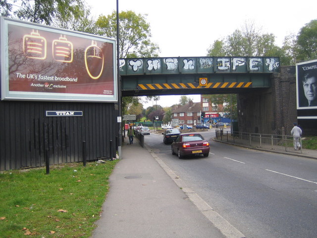
Image: © Nigel Cox Taken: 24 Oct 2007
The bridge carries Network Rail's trackwork over this notorious traffic bottleneck where the A312 and A4090 roads meet and cross over, just west of Northolt Park railway station. The boundary between the London Borough of Ealing and the London Borough of Harrow is on the far side of the bridge, Ealing being this side and Harrow on the far side. I seem to recall that up until quite recently this was a narrower brick bridge with the pedestrian pavements on either side passing through their own separate arches.
Images are licensed for reuse under creativecommons.org/licenses/by-sa/2.0
Image Location
Latitude
51.556056
Longitude
-0.362794