
Star Bridge
Introduction
The photograph on this page of Star Bridge by Ian Capper as part of the Geograph project.
The Geograph project started in 2005 with the aim of publishing, organising and preserving representative images for every square kilometre of Great Britain, Ireland and the Isle of Man.

There are currently over 7.5m images from over 14,400 individuals and you can help contribute to the project by visiting https://www.geograph.org.uk
Star Bridge
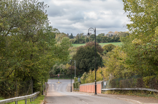
Image: © Ian Capper Taken: 27 Oct 2018
Bridge carrying Netherne Drive over the Brighton Lines before meeting the A23 Brighton Road (seen in the background). The bridge was named after the Star Inn which stood alongside the Brighton Road opposite the junction until demolition in 1977 to make way for a road widening scheme. There are in fact two bridges - the nearer one carries the road over the 1899 Quarry Line, built by the LB&SCR to avoid Redhill whilst the other one, just visible in the background, carries the road over the original 1841 line through Redhill.
Images are licensed for reuse under creativecommons.org/licenses/by-sa/2.0
Image Location

Latitude
51.295903
Longitude
-0.151747