
St Botholph's church in Limpenhoe
Introduction
The photograph on this page of St Botholph's church in Limpenhoe by Evelyn Simak as part of the Geograph project.
The Geograph project started in 2005 with the aim of publishing, organising and preserving representative images for every square kilometre of Great Britain, Ireland and the Isle of Man.

There are currently over 7.5m images from over 14,400 individuals and you can help contribute to the project by visiting https://www.geograph.org.uk
St Botholph's church in Limpenhoe
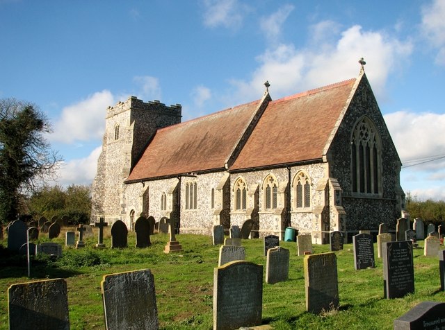
Image: © Evelyn Simak Taken: 2 Nov 2018
In the late 12th century St Botolph's church > http://www.geograph.org.uk/photo/1520246 was given to Hugh, Abbot of Langley (the abbey > http://www.geograph.org.uk/photo/1342980 was situated just across the River Yare) in exchange for a church in Buckinghamshire. Until its reconstruction in 1881 the church remained a simple rectangular structure with a thatched roof. When the roof was removed in 1907 the walls collapsed outwards and little of the original building remained standing but a Norman doorway > http://www.geograph.org.uk/photo/1520174 can still be seen in the south wall. The rebuilding of St Botolph was connected with the closure of the neighbouring St Edmund's church > http://www.geograph.org.uk/photo/627777 in Southwood, the ruin of which is still standing. The east window > http://www.geograph.org.uk/photo/1520255 was designed and installed by a firm in Great Yarmouth who also designed the reredos and pulpit but all records were lost during the war. A 17th century Flemish tapestry > http://www.geograph.org.uk/photo/1520261 originating from St Edmund's church in Southwood can be seen on the nave south wall. The C13 font > http://www.geograph.org.uk/photo/1520270 came from St Edmund's also.
Images are licensed for reuse under creativecommons.org/licenses/by-sa/2.0
Image Location

Latitude
52.580837
Longitude
1.533808