Marker for Caerleon's ancient East Gate
Introduction
The photograph on this page of Marker for Caerleon's ancient East Gate by Jaggery as part of the Geograph project.
The Geograph project started in 2005 with the aim of publishing, organising and preserving representative images for every square kilometre of Great Britain, Ireland and the Isle of Man.

There are currently over 7.5m images from over 14,400 individuals and you can help contribute to the project by visiting https://www.geograph.org.uk
Marker for Caerleon's ancient East Gate
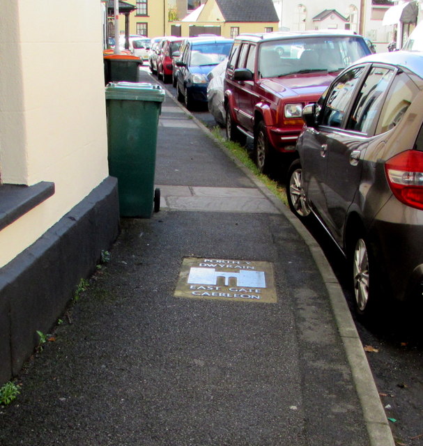
Image: © Jaggery Taken: 1 Nov 2018
In the Backhall Street pavement marking the location of the east gate of the ancient Roman legionary fortress of Isca Silurum (or Isca Augusta), the present-day Caerleon. https://www.geograph.org.uk/photo/5961722 to a closer view. The name Caerleon probably derives from the Welsh for Fortress of the Legion.
Images are licensed for reuse under creativecommons.org/licenses/by-sa/2.0
Image Location
Latitude
51.611703
Longitude
-2.953533