Holland-on-Sea: Port of London Authority Holland Haven Radar Mast
Introduction
The photograph on this page of Holland-on-Sea: Port of London Authority Holland Haven Radar Mast by Nigel Cox as part of the Geograph project.
The Geograph project started in 2005 with the aim of publishing, organising and preserving representative images for every square kilometre of Great Britain, Ireland and the Isle of Man.

There are currently over 7.5m images from over 14,400 individuals and you can help contribute to the project by visiting https://www.geograph.org.uk
Holland-on-Sea: Port of London Authority Holland Haven Radar Mast
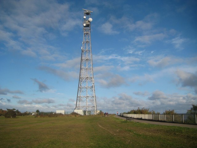
Image: © Nigel Cox Taken: 27 Oct 2018
This is one of the fifteen radar masts that form the Port of London Authority (PLA)'s network, which oversees the River Thames and its estuary. Data from these radars is transmitted via microwave links to the PLA's Vessel Traffic Centres at Gravesend and the Thames Barrier, providing a full picture of all shipping movements to and from the River Thames and its outer estuary.
Images are licensed for reuse under creativecommons.org/licenses/by-sa/2.0
Image Location
Latitude
51.808992
Longitude
1.214919