Lynton and Barnstaple Railway ? Platelayers Hut
Introduction
The photograph on this page of Lynton and Barnstaple Railway ? Platelayers Hut by Barrie Cann as part of the Geograph project.
The Geograph project started in 2005 with the aim of publishing, organising and preserving representative images for every square kilometre of Great Britain, Ireland and the Isle of Man.

There are currently over 7.5m images from over 14,400 individuals and you can help contribute to the project by visiting https://www.geograph.org.uk
Lynton and Barnstaple Railway ? Platelayers Hut
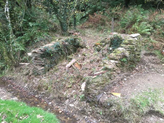
Image: © Barrie Cann Taken: 25 Oct 2018
Remains of what was likely to have been a Platelayer’s Hut. This will be carefully excavated to discover what lies under all this rubble and spoil. There is the possibility this could be rebuilt over time. The Lynton & Barnstaple Railway was a 19 mile long narrow gauge railway, which ran across the stunning Exmoor landscape, from 1898, until its closure in 1935. In 2004, after many years of hard work and negotiation, a small section was re-opened. It is hoped that this section will soon be completely cleared, and become a working part of the railway once more. One of the world’s most famous little railways, you can read more of the exciting plans for the coming years at www.lynton-rail.co.uk
Images are licensed for reuse under creativecommons.org/licenses/by-sa/2.0
Image Location
Latitude
51.174337
Longitude
-3.930698