How Wood: Park Street Lane railway bridge
Introduction
The photograph on this page of How Wood: Park Street Lane railway bridge by Nigel Cox as part of the Geograph project.
The Geograph project started in 2005 with the aim of publishing, organising and preserving representative images for every square kilometre of Great Britain, Ireland and the Isle of Man.

There are currently over 7.5m images from over 14,400 individuals and you can help contribute to the project by visiting https://www.geograph.org.uk
How Wood: Park Street Lane railway bridge
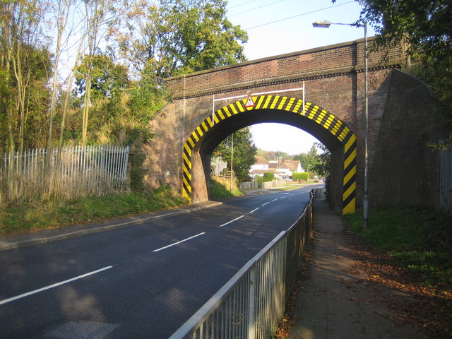
Image: © Nigel Cox Taken: 23 Oct 2007
This skew bridge carries the single track branch railway line from Watford Junction to St Albans Abbey over Park Street Lane. The yellow and black edging serves as a warning of the limited clearance to drivers of large vehicles. The height restriction is 13' 9" or 4.19 metres between the two vertical white bars.
Images are licensed for reuse under creativecommons.org/licenses/by-sa/2.0
Image Location
Latitude
51.721224
Longitude
-0.342357