Harefield Road from High Street, Uxbridge
Introduction
The photograph on this page of Harefield Road from High Street, Uxbridge by Andrew Curtis as part of the Geograph project.
The Geograph project started in 2005 with the aim of publishing, organising and preserving representative images for every square kilometre of Great Britain, Ireland and the Isle of Man.

There are currently over 7.5m images from over 14,400 individuals and you can help contribute to the project by visiting https://www.geograph.org.uk
Harefield Road from High Street, Uxbridge
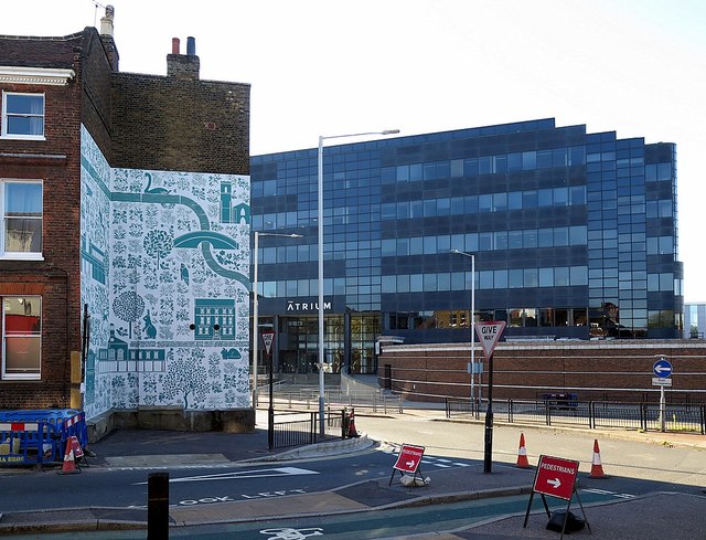
Image: © Andrew Curtis Taken: 21 Oct 2018
Across the road, No 66 High Street (The Cedars) Image, has had its untidy side draped with a mural reflecting the Uxbridge landscape. The mural is part of a display celebrating Uxbridge's close association with Arthur Sanderson & Sons who opened a textile-printing factory here in 1919 https://en.wikipedia.org/wiki/Arthur_Sanderson_%26_Sons A continuation of the design on the end wall incorporates a picture of Kate Fassnidge (1893-1950), a benefactor of the town Image
Images are licensed for reuse under creativecommons.org/licenses/by-sa/2.0
Image Location
Latitude
51.548663
Longitude
-0.481758