Former railway bridge, Liverpool Road, Buckley
Introduction
The photograph on this page of Former railway bridge, Liverpool Road, Buckley by John S Turner as part of the Geograph project.
The Geograph project started in 2005 with the aim of publishing, organising and preserving representative images for every square kilometre of Great Britain, Ireland and the Isle of Man.

There are currently over 7.5m images from over 14,400 individuals and you can help contribute to the project by visiting https://www.geograph.org.uk
Former railway bridge, Liverpool Road, Buckley
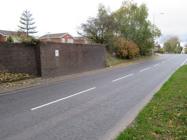
Image: © John S Turner Taken: 25 Oct 2018
Looking across Liverpool Road towards an unremarkable brick wall. Nevertheless this was once part of a railway bridge that carried The Buckley Railway Company line down to the docks on the River Dee at Connahs Quay. The line opened in 1862 and was essential to the development of the pottery, brick and coal industries in the Buckley area. The white sign was placed on the wall in 2012 by the Buckley Society to commemorate the 150th anniversary of the line opening - Image There is an Ordnance Survey bench mark on the left hand corner of the wall facing the road - Image
Images are licensed for reuse under creativecommons.org/licenses/by-sa/2.0
Image Location
Latitude
53.180678
Longitude
-3.073268