Air ministry boundary marker
Introduction
The photograph on this page of Air ministry boundary marker by Ian Capper as part of the Geograph project.
The Geograph project started in 2005 with the aim of publishing, organising and preserving representative images for every square kilometre of Great Britain, Ireland and the Isle of Man.

There are currently over 7.5m images from over 14,400 individuals and you can help contribute to the project by visiting https://www.geograph.org.uk
Air ministry boundary marker
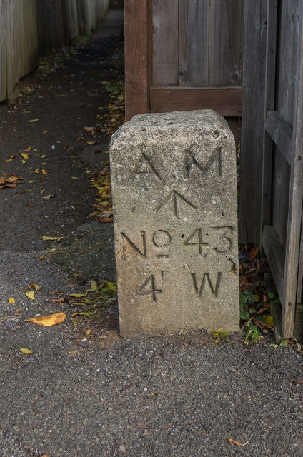
Image: © Ian Capper Taken: 12 Oct 2018
Air ministry boundary marker at one end of a footpath linking Foxon Lane and Buxton Lane. This dates from the Second World War and is associated with nearby RAF Kenley. There is a similar on at the other end of the footpath in Buxton Lane. For a wider view see Image
Images are licensed for reuse under creativecommons.org/licenses/by-sa/2.0
Image Location
Latitude
51.294155
Longitude
-0.093741