View from the footbridge at Pevensey & Westham station
Introduction
The photograph on this page of View from the footbridge at Pevensey & Westham station by Marathon as part of the Geograph project.
The Geograph project started in 2005 with the aim of publishing, organising and preserving representative images for every square kilometre of Great Britain, Ireland and the Isle of Man.

There are currently over 7.5m images from over 14,400 individuals and you can help contribute to the project by visiting https://www.geograph.org.uk
View from the footbridge at Pevensey & Westham station
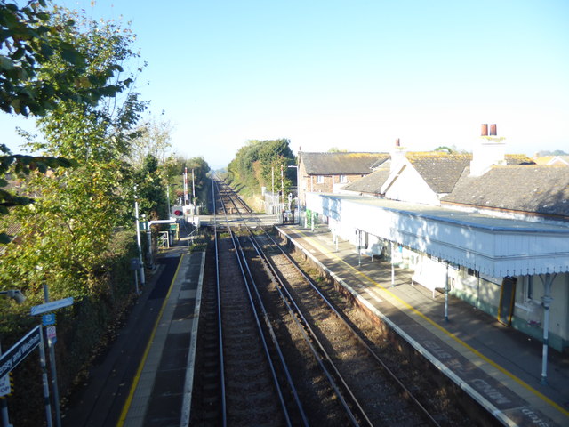
Image: © Marathon Taken: 21 Oct 2018
The Brighton, Lewes & Hastings Railway existed from February 1844 but only operated trains for a few weeks during June and July 1846 before it was amalgamated with other companies to form the London Brighton & South Coast Railway on 27th July 1846. Pevensey & Westham station opened as Westham & Pevensey on the same day as the rest of the line (27th July 1846) between Lewes and St.Leonards (Bulverhythe). It was renamed Pevensey & Westham in January 1851 but in November 1851 was renamed Pevensey until January 1890 when it received its present name. This view from the footbridge looks towards Eastbourne. The next station in this direction is Hampden Park.
Images are licensed for reuse under creativecommons.org/licenses/by-sa/2.0
Image Location
Latitude
50.815541
Longitude
0.323687