Lake Farm
Introduction
The photograph on this page of Lake Farm by Derek Harper as part of the Geograph project.
The Geograph project started in 2005 with the aim of publishing, organising and preserving representative images for every square kilometre of Great Britain, Ireland and the Isle of Man.

There are currently over 7.5m images from over 14,400 individuals and you can help contribute to the project by visiting https://www.geograph.org.uk
Lake Farm
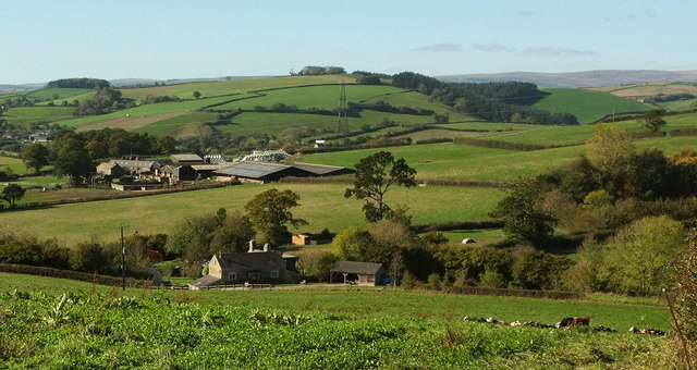
Image: © Derek Harper Taken: 22 Oct 2018
And other farms, but only Lake is in this square. The listed farmhouse at Lake is described at https://historicengland.org.uk/listing/the-list/list-entry/1097327 : "Despite alterations this house contains some good quality C17 features". Prominent beyond on the left is Younghouse, with Gullaford further off on the extreme left, across the River Hems valley. The hilltop wood on the left is Penn Plantation; the larger wood right of centre is Hooper Hayes Copse. This is a lovely area of South Devon. The view is from Blackwell Lane, between Purcombe Cross and Waytown Cross.
Images are licensed for reuse under creativecommons.org/licenses/by-sa/2.0
Image Location
Latitude
50.49867
Longitude
-3.705173