Mote Hill: western side of the ancient fort
Introduction
The photograph on this page of Mote Hill: western side of the ancient fort by Lairich Rig as part of the Geograph project.
The Geograph project started in 2005 with the aim of publishing, organising and preserving representative images for every square kilometre of Great Britain, Ireland and the Isle of Man.

There are currently over 7.5m images from over 14,400 individuals and you can help contribute to the project by visiting https://www.geograph.org.uk
Mote Hill: western side of the ancient fort
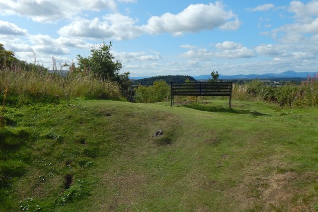
Image: © Lairich Rig Taken: 25 Aug 2018
This is the western side of the summit. What looks like a linear mound crossing the image from left to right, on the near side of the bench, may be part of the outline of the fort described at the Canmore link given in the end-note. The view is from the interior of the fort, looking out across its wall. See Image for further possible traces on the opposite side of the summit. The prominent skyline hill near the right-hand edge of the present picture is Ben Ledi (Image).
Images are licensed for reuse under creativecommons.org/licenses/by-sa/2.0
Image Location
Latitude
56.127652
Longitude
-3.943045