
Pound's Cross
Introduction
The photograph on this page of Pound's Cross by Derek Harper as part of the Geograph project.
The Geograph project started in 2005 with the aim of publishing, organising and preserving representative images for every square kilometre of Great Britain, Ireland and the Isle of Man.

There are currently over 7.5m images from over 14,400 individuals and you can help contribute to the project by visiting https://www.geograph.org.uk
Pound's Cross
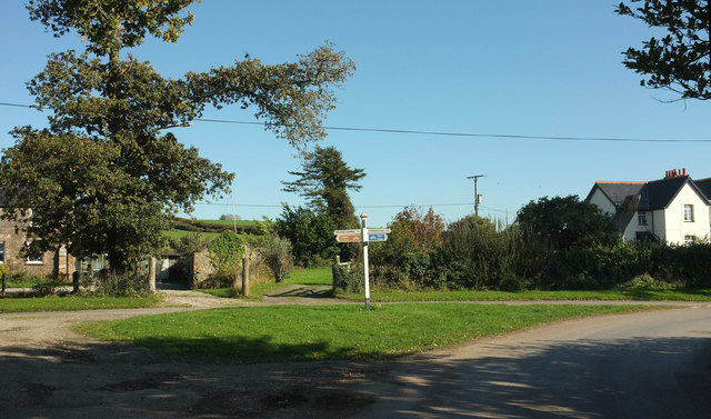
Image: © Derek Harper Taken: 20 Oct 2018
A tad confusing here. The large scale OS map names this junction by the Old School House (left) and Lodge Cottages as "Pound's Cross", but many maps, including smaller scale OS maps, call the junction about 150 metres SSE from here, and in a different square, "Pound Cross". The usual arbiter would be the signpost, but this side of the post is silent on the issue, and Streetview suggests the other faces are similarly empty. However, the other Pound Cross has its name confirmed on its signpost. This is a earlier autumn version of Image, with leaves still mostly on the trees.
Images are licensed for reuse under creativecommons.org/licenses/by-sa/2.0
Image Location

Latitude
50.456942
Longitude
-4.135343