Leeds Inner Ring Road - Stage 7 (6)
Introduction
The photograph on this page of Leeds Inner Ring Road - Stage 7 (6) by Steve Partridge as part of the Geograph project.
The Geograph project started in 2005 with the aim of publishing, organising and preserving representative images for every square kilometre of Great Britain, Ireland and the Isle of Man.

There are currently over 7.5m images from over 14,400 individuals and you can help contribute to the project by visiting https://www.geograph.org.uk
Leeds Inner Ring Road - Stage 7 (6)
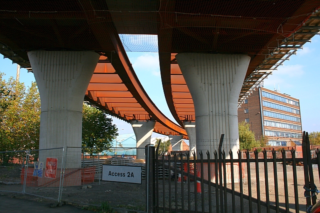
Image: © Steve Partridge Taken: 21 Oct 2007
Viewed from Donisthorpe Street. Stage 7 is a major £50m construction project which will complete the City's Inner Ring Road, and provide improved access to and from the M621. It involves the construction of a dual carriageway flyover from Richmond Hill Bridge over Hunslet Road and on to the Hunslet Distributor. A new roundabout is being built at the junction of South Accommodation Road, Atkinson Street and Clarence Road. There will also be considerable changes to the access and exit arrangements at Junction 4 of the southbound M621.
Images are licensed for reuse under creativecommons.org/licenses/by-sa/2.0
Image Location
Latitude
53.784307
Longitude
-1.530997