St Martin's Church Street, Salisbury - south side
Introduction
The photograph on this page of St Martin's Church Street, Salisbury - south side by Stephen Craven as part of the Geograph project.
The Geograph project started in 2005 with the aim of publishing, organising and preserving representative images for every square kilometre of Great Britain, Ireland and the Isle of Man.

There are currently over 7.5m images from over 14,400 individuals and you can help contribute to the project by visiting https://www.geograph.org.uk
St Martin's Church Street, Salisbury - south side
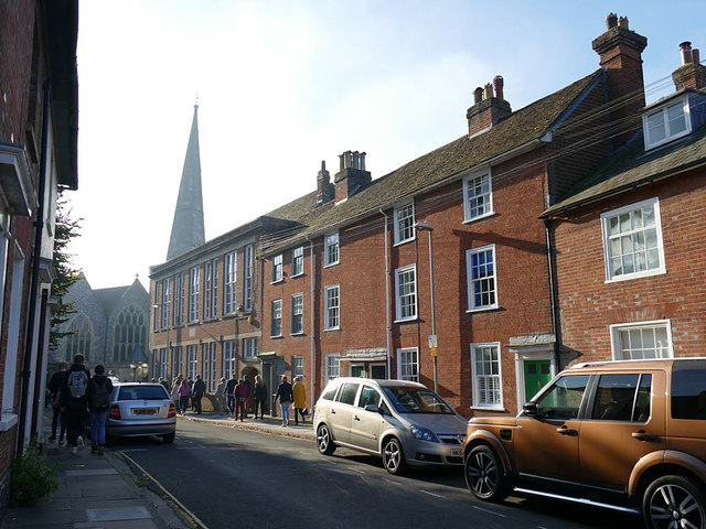
Image: © Stephen Craven Taken: 27 Sep 2018
The origin of the street name is obvious in this view. The building at the far end of the south side of the street is St Martin's Church Centre, a former school Image as may be evidenced from the tall windows.
Images are licensed for reuse under creativecommons.org/licenses/by-sa/2.0
Image Location
Latitude
51.065631
Longitude
-1.787598