15 Stanstead Road
Introduction
The photograph on this page of 15 Stanstead Road by Ian Capper as part of the Geograph project.
The Geograph project started in 2005 with the aim of publishing, organising and preserving representative images for every square kilometre of Great Britain, Ireland and the Isle of Man.

There are currently over 7.5m images from over 14,400 individuals and you can help contribute to the project by visiting https://www.geograph.org.uk
15 Stanstead Road
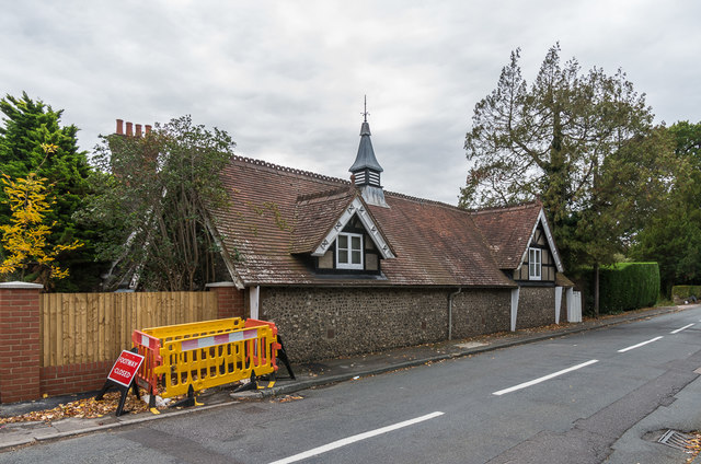
Image: © Ian Capper Taken: 12 Oct 2018
The rear of the former stable block to Woodside, here backing onto Stanstead Road, dating from 1861. Woodside itself was demolished in around the 1960s with housing built in its grounds along Stanstead Road.
Images are licensed for reuse under creativecommons.org/licenses/by-sa/2.0
Image Location
Latitude
51.280876
Longitude
-0.086777