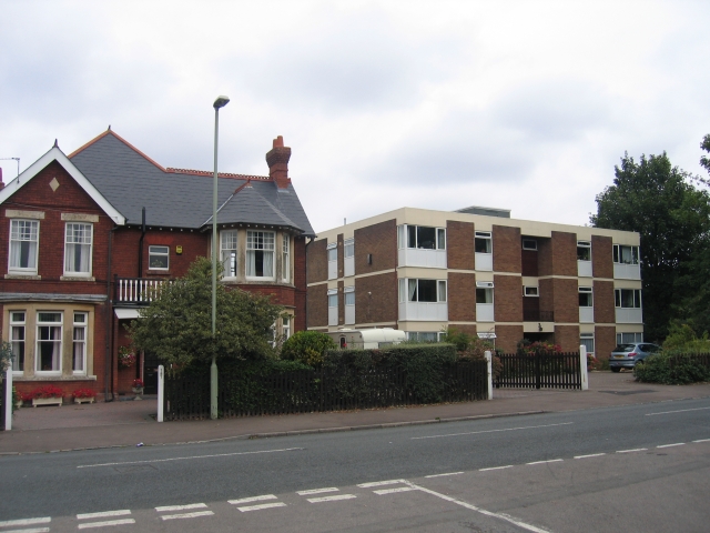
Tuffley Avenue, Gloucester
Introduction
The photograph on this page of Tuffley Avenue, Gloucester by David Stowell as part of the Geograph project.
The Geograph project started in 2005 with the aim of publishing, organising and preserving representative images for every square kilometre of Great Britain, Ireland and the Isle of Man.
There are currently over 7.5m images from over 14,400 individuals and you can help contribute to the project by visiting https://www.geograph.org.uk

Image: © David Stowell Taken: 18 Sep 2005
The house on the left is typical of many in this part of this mainly residential square. The building on the right replaced a house demolished when a 'plane crashed into it on the 27th March 1963. A twin engined Vickers Varsity aircraft crashed onto the house. The three elderly occupants survived unhurt apart from shock and scratches, however the house and the neighbouring property that the Drury family also owned were flooded with aviation fuel. The plane was on a training run from Staverton Airport and tragically the crew of two were killed. See:- http://aviation-safety.net/database/record.php?id=19630327-0 and http://www.visit-gloucestershire.co.uk/boards/topic/72-g-apaz-the-tuffley-varsity/ . From a personal perspective I remember cycling home from school nearby and seeing the area cordonned off and the remains of the fuselage embedded in the top half of the house.

