Simm's Bridge
Introduction
The photograph on this page of Simm's Bridge by David Stowell as part of the Geograph project.
The Geograph project started in 2005 with the aim of publishing, organising and preserving representative images for every square kilometre of Great Britain, Ireland and the Isle of Man.

There are currently over 7.5m images from over 14,400 individuals and you can help contribute to the project by visiting https://www.geograph.org.uk
Simm's Bridge
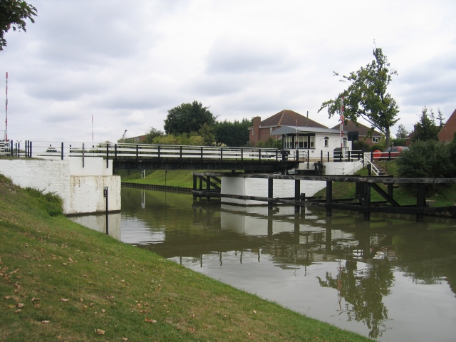
Image: © David Stowell Taken: 18 Sep 2005
One of the many swing bridges on the Gloucester and Sharpness Canal. There are no fixed bridges over the canal enabling seagoing vessels unlimited headroom all the way to Gloucester Docks. Even the new bypass bridge being built just around the corner, http://www.gloucesterdocks.me.uk/canal/twomilecut/2mcutplans.htm although being at a high level to allow the majority of boats to pass unimpeded, will be capable of being open to allow the sighting of the tall ships in Gloucester Docks to continue.
Images are licensed for reuse under creativecommons.org/licenses/by-sa/2.0
Image Location


Leaflet Map data © OpenStreetMap
Latitude
51.837776
Longitude
-2.278616