East Garston: stream-bed of the Lambourn, October 2018
Introduction
The photograph on this page of East Garston: stream-bed of the Lambourn, October 2018 by Stefan Czapski as part of the Geograph project.
The Geograph project started in 2005 with the aim of publishing, organising and preserving representative images for every square kilometre of Great Britain, Ireland and the Isle of Man.

There are currently over 7.5m images from over 14,400 individuals and you can help contribute to the project by visiting https://www.geograph.org.uk
East Garston: stream-bed of the Lambourn, October 2018
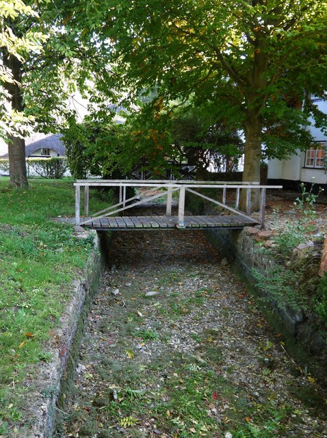
Image: © Stefan Czapski Taken: 10 Oct 2018
'Bourn' is often met with in the names of streams in chalky counties such as Berkshire, Hampshire, Wiltshire and Dorset - and is generally understood to indicate a stream which flows seasonally, drying up in summer. In this instance, the Lambourn seemed pretty much bone-dry in October - even though the summer's drought had been followed by a good deal of wet weather. At East Garston the stream-bed is crossed by at least five of these little pedestrian bridges, giving access to cottages. It occurs to me that a number of 'bourn' villages I've visited while Geographing have features in common - in that the stream has been canalised into a narrow bed, and the older dwellings are strung out along it, built directly on its banks. Economic use must have been made of the stream, even though it flowed for just a few months of the year. Winterbourne, West Berkshire, comes to mind Image Image and so does Image, in Wiltshire.
Images are licensed for reuse under creativecommons.org/licenses/by-sa/2.0
Image Location
Latitude
51.489716
Longitude
-1.480293