The halfway point?
Introduction
The photograph on this page of The halfway point? by Gordon Hatton as part of the Geograph project.
The Geograph project started in 2005 with the aim of publishing, organising and preserving representative images for every square kilometre of Great Britain, Ireland and the Isle of Man.

There are currently over 7.5m images from over 14,400 individuals and you can help contribute to the project by visiting https://www.geograph.org.uk
The halfway point?
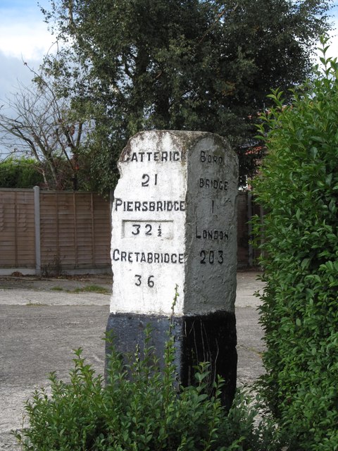
Image: © Gordon Hatton Taken: 8 Oct 2018
Information produced locally suggests that this old milestone marks the halfway point between London and Edinburgh. The problem is that whilst London is shown as 203 miles, there is no reference to Edinburgh on the other side. This stands by one of several 'Great North Road' routes, another being just half a mile to the east along what is now a dead end country lane, but pre WW2 it was the A167 and before that a stagecoach route to the north via Topcliffe and Northallerton.
Images are licensed for reuse under creativecommons.org/licenses/by-sa/2.0
Image Location
Latitude
54.1093
Longitude
-1.407269