Burghley Road "PlaySpace"
Introduction
The photograph on this page of Burghley Road "PlaySpace" by Neil Theasby as part of the Geograph project.
The Geograph project started in 2005 with the aim of publishing, organising and preserving representative images for every square kilometre of Great Britain, Ireland and the Isle of Man.

There are currently over 7.5m images from over 14,400 individuals and you can help contribute to the project by visiting https://www.geograph.org.uk
Burghley Road "PlaySpace"
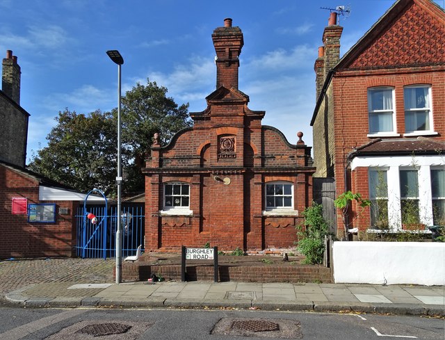
Image: © Neil Theasby Taken: 7 Oct 2018
A community centre for the under fives. I have been unable to find out much about its previous history and would welcome elucidation. It was first opened in 1897, possibly as a school?
Images are licensed for reuse under creativecommons.org/licenses/by-sa/2.0
Image Location
Latitude
51.590521
Longitude
-0.107331