Marlow, obelisk
Introduction
The photograph on this page of Marlow, obelisk by Mike Faherty as part of the Geograph project.
The Geograph project started in 2005 with the aim of publishing, organising and preserving representative images for every square kilometre of Great Britain, Ireland and the Isle of Man.

There are currently over 7.5m images from over 14,400 individuals and you can help contribute to the project by visiting https://www.geograph.org.uk
Marlow, obelisk
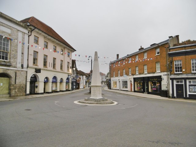
Image: © Mike Faherty Taken: 6 Oct 2018
Obelisk milestone at the junction of High, West and Chapel Streets, showing the distances to Maidenhead, Reading (by two routes), London, Bath, Wycombe, Aylesbury, Oxford (by two routes), Hatfield, Henley & Abingdon. Erected 1822, listed by Historic England, and recently excellently refurbished by the Marlow Society: http://www.marlowsociety.org.uk/news_8/index.php http://www.imagesofengland.org.uk/details/default.aspx?id=46237
Images are licensed for reuse under creativecommons.org/licenses/by-sa/2.0
Image Location


Leaflet Map data © OpenStreetMap
Latitude
51.571894
Longitude
-0.777084