Moorsholm Docks
Introduction
The photograph on this page of Moorsholm Docks by Mick Garratt as part of the Geograph project.
The Geograph project started in 2005 with the aim of publishing, organising and preserving representative images for every square kilometre of Great Britain, Ireland and the Isle of Man.

There are currently over 7.5m images from over 14,400 individuals and you can help contribute to the project by visiting https://www.geograph.org.uk
Moorsholm Docks
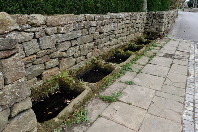
Image: © Mick Garratt Taken: 4 Oct 2018
Right on the High Street of this delightful little village that just missed out on the ironstone mining activities of the rest of East Cleveland, is a row of six sunken sandstone water troughs that have become known as the Moorsholm Docks. Probably dating from the 19th-century they are fed by piped water from a spring on the moors. The name seems to be a bit of a mystery; some suggest it came about purely as a result of a ‘wag’. From my blog http://www.fhithich.uk/?p=20284
Images are licensed for reuse under creativecommons.org/licenses/by-sa/2.0
Image Location
Latitude
54.520936
Longitude
-0.936922