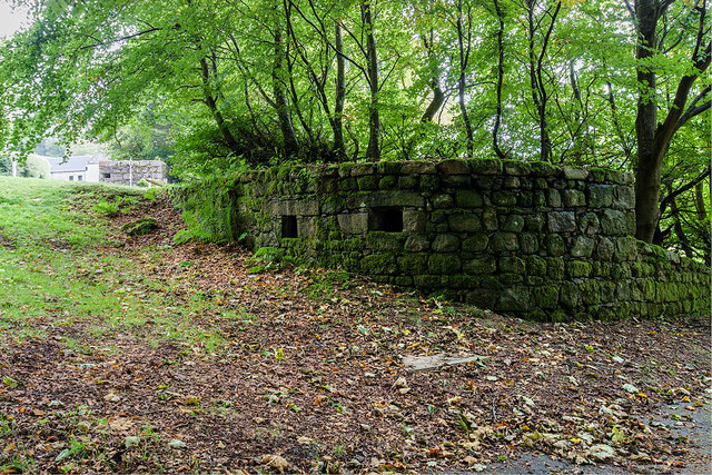
Bridge of Dye WWII Pillboxes (1)
Introduction
The photograph on this page of Bridge of Dye WWII Pillboxes (1) by Mike Searle as part of the Geograph project.
The Geograph project started in 2005 with the aim of publishing, organising and preserving representative images for every square kilometre of Great Britain, Ireland and the Isle of Man.
There are currently over 7.5m images from over 14,400 individuals and you can help contribute to the project by visiting https://www.geograph.org.uk

Image: © Mike Searle Taken: 18 Sep 2018
- Pillbox: EDoB ID: S0003013 Of the large number of pillboxes at bridges in Aberdeenshire, these two are among the more interesting. The first is an almost circular pillbox of local granite blocks, one of two situated to the E of the original line of the B974 road, with the line of the new road now running between them. Both structures appear to be part of a line designed to block the passes across the Mounth and the hills to the west, to halt any southern-moving invasion force arriving on the beaches of Aberdeenshire. The pillbox has been carefully disguised to look like the granite wall surrounding the garden of the farmhouse. A second pillbox on the opposite side of the road can be seen in the middle distance. Image

