Deptford: Former Payne's Paper Wharf
Introduction
The photograph on this page of Deptford: Former Payne's Paper Wharf by Nigel Cox as part of the Geograph project.
The Geograph project started in 2005 with the aim of publishing, organising and preserving representative images for every square kilometre of Great Britain, Ireland and the Isle of Man.

There are currently over 7.5m images from over 14,400 individuals and you can help contribute to the project by visiting https://www.geograph.org.uk
Deptford: Former Payne's Paper Wharf
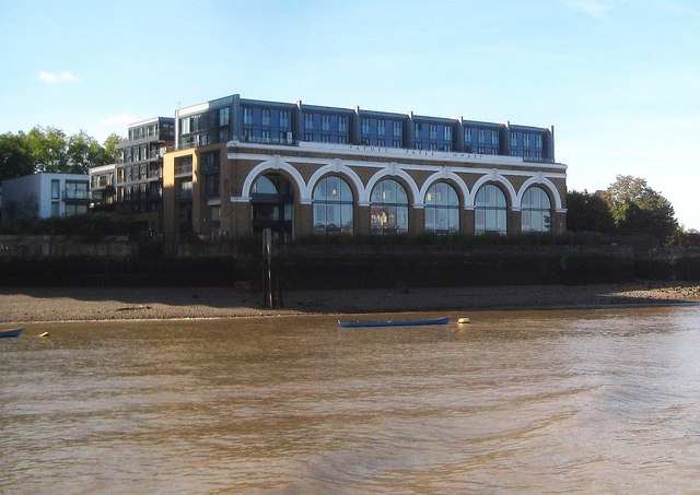
Image: © Nigel Cox Taken: 29 Sep 2018
Only the six arch Italianate façade of the riverside wall of the original building here survives, as the structure behind and above is a modern residential development. The façade was the riverside frontage of a marine boiler works, constructed about 1860 for J Penn and Sons, marine engineers, and is shown as such on the Ordnance Survey map of 1873-1874. Only by the time that the 1951 map was published is it shown as Payne's Wharf. The surviving façade is a Grade II Listed structure. The old maps also show that the Surrey side terminus of the original ferry between Deptford and the Isle of Dogs was to the right of the building and that the street that the current building is on, Borthwick Street, was once known as Butchers Row.
Images are licensed for reuse under creativecommons.org/licenses/by-sa/2.0
Image Location
Latitude
51.485382
Longitude
-0.024548