Junction of Monk Street and Lower Monk Street, Abergavenny
Introduction
The photograph on this page of Junction of Monk Street and Lower Monk Street, Abergavenny by Jaggery as part of the Geograph project.
The Geograph project started in 2005 with the aim of publishing, organising and preserving representative images for every square kilometre of Great Britain, Ireland and the Isle of Man.

There are currently over 7.5m images from over 14,400 individuals and you can help contribute to the project by visiting https://www.geograph.org.uk
Junction of Monk Street and Lower Monk Street, Abergavenny
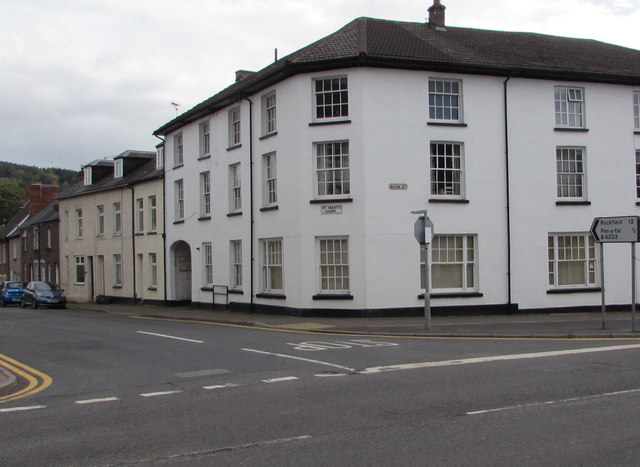
Image: © Jaggery Taken: 30 Sep 2018
On the right, the sign alongside the A40 Monk Street points towards the B4233 Lower Monk Street. The sign shows 12 (miles) to Rockfield, half a mile to Pen-y-fal. St Mary's Court flats are on the corner. This is the western end of the B4233 which extends for 23km to Monmouth via Llantilio Crossenny. The Sabre website states that the B4233 has the distinction of being the lowest numbered Class II road wholly in Wales in the 1922 Road Lists.
Images are licensed for reuse under creativecommons.org/licenses/by-sa/2.0
Image Location
Latitude
51.822484
Longitude
-3.01529