Water Row at Govan Road
Introduction
The photograph on this page of Water Row at Govan Road by Thomas Nugent as part of the Geograph project.
The Geograph project started in 2005 with the aim of publishing, organising and preserving representative images for every square kilometre of Great Britain, Ireland and the Isle of Man.

There are currently over 7.5m images from over 14,400 individuals and you can help contribute to the project by visiting https://www.geograph.org.uk
Water Row at Govan Road
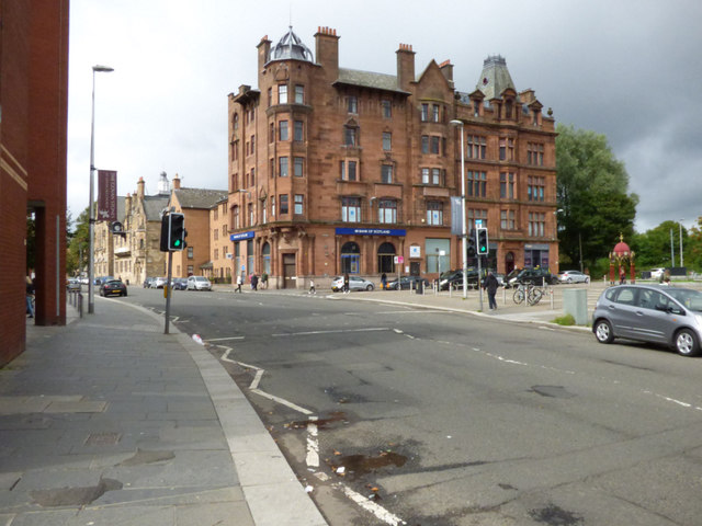
Image: © Thomas Nugent Taken: 27 Aug 2018
Govan Road is in the foreground. The prominent red sandstone building is the former British Linen Bank and YMCA building at the corner of Water Row. The bank (on the left) is Category A Listed http://portal.historicenvironment.scot/designation/LB33351 . The flats in the centre are also included in the listing. The YMCA part of the building (on the right) is Category B Listed http://portal.historicenvironment.scot/designation/LB33362 .
Images are licensed for reuse under creativecommons.org/licenses/by-sa/2.0
Image Location
Latitude
55.86309
Longitude
-4.311759