Eighteenth century house on Burford Drive, Stroud
Introduction
The photograph on this page of Eighteenth century house on Burford Drive, Stroud by Derek Harper as part of the Geograph project.
The Geograph project started in 2005 with the aim of publishing, organising and preserving representative images for every square kilometre of Great Britain, Ireland and the Isle of Man.

There are currently over 7.5m images from over 14,400 individuals and you can help contribute to the project by visiting https://www.geograph.org.uk
Eighteenth century house on Burford Drive, Stroud
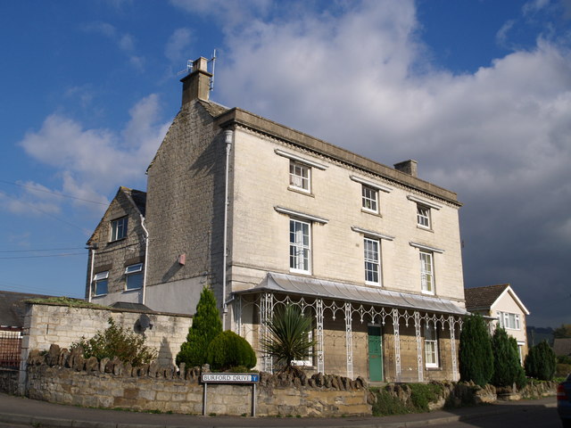
Image: © Derek Harper Taken: 19 Oct 2007
Rather an unexpected sight amidst a modern suburban estate, with its impressive three storeys, cornice, straightforward stringcourses, and tented verandah with delicate ironwork. Numbered 1-3 on the map, so presumably divided into flats.
Images are licensed for reuse under creativecommons.org/licenses/by-sa/2.0
Image Location


Leaflet Map data © OpenStreetMap
Latitude
51.745728
Longitude
-2.227789