Westgate Cottage, Abergavenny
Introduction
The photograph on this page of Westgate Cottage, Abergavenny by Jaggery as part of the Geograph project.
The Geograph project started in 2005 with the aim of publishing, organising and preserving representative images for every square kilometre of Great Britain, Ireland and the Isle of Man.

There are currently over 7.5m images from over 14,400 individuals and you can help contribute to the project by visiting https://www.geograph.org.uk
Westgate Cottage, Abergavenny
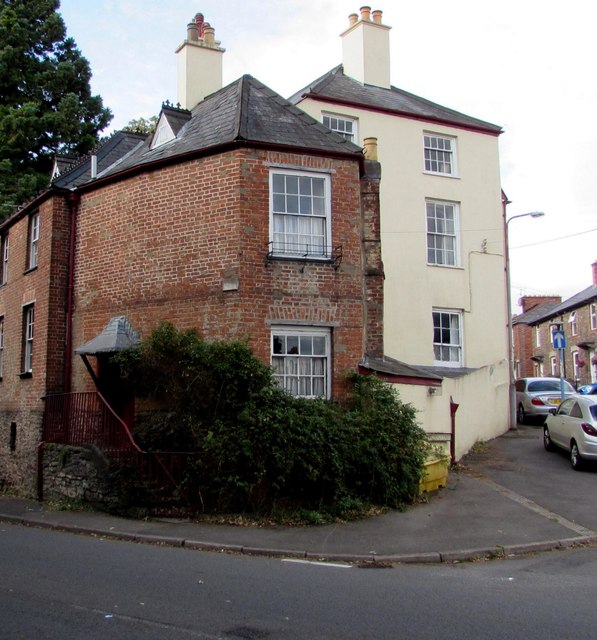
Image: © Jaggery Taken: 30 Sep 2018
Grade II listed Westgate Cottage on the left dates from c1820. Its location on the corner of Merthyr Road and Union Road East suggests it may once have been a turnpike tollhouse. A tollgate is shown in place on the White's Guide plan of 1877. Named The Westgate, the white house next door in Union Road East is also Grade II listed.
Images are licensed for reuse under creativecommons.org/licenses/by-sa/2.0
Image Location


Leaflet Map data © OpenStreetMap
Latitude
51.821496
Longitude
-3.025569